The United Kingdom is bracing for severe weather as Storm Boelo approaches, bringing powerful winds and heavy rainfall that could cause flooding across several regions. The UK Met Office has issued warnings about potentially life-threatening conditions, urging people in affected areas to take precautions as the storm moves towards the country.
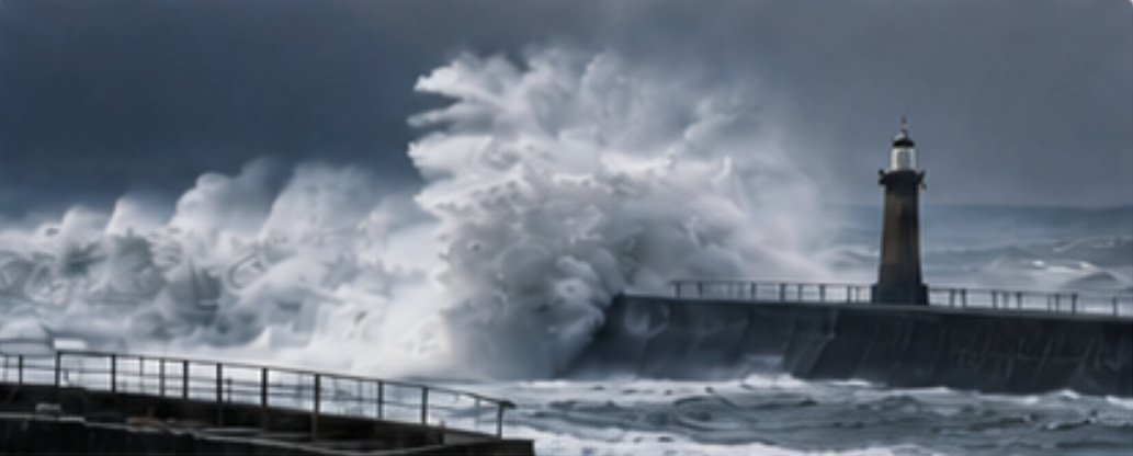
Boelo, the second named storm of the current season, is expected to affect parts of Scotland, Northern Ireland and northern England, with wind speeds forecast to reach 70 miles per hour in some locations. Along exposed coastal areas, gusts could climb to 80 mph, equivalent to approximately 129 km/h, creating dangerous conditions for residents, motorists and anyone planning to travel.
The approaching storm comes shortly after Storm Austen caused widespread disruption on Friday. Thousands of households in Cornwall were left without electricity, while several schools were forced to close because of the adverse weather.
The Met Office issued amber weather warnings on Saturday for parts of the United Kingdom as forecasters prepared for a potentially dangerous combination of high winds and heavy rain.
Scotland, Northern Ireland and the far north of England are among the areas expected to experience some of the most severe conditions. In exposed locations, powerful gusts could make travel hazardous and increase the risk of damage to buildings, trees and infrastructure.
Winds Could Reach 129 km/h in Coastal Areas
Wind speeds associated with Storm Boelo are expected to vary depending on location and exposure. Gusts could reach 70 mph in some areas, while coastal locations may experience speeds of up to 80 mph.
At approximately 129 km/h, winds of this strength can create dangerous conditions, particularly along exposed coastlines, on bridges and on elevated roads. Flying debris, falling branches and damaged structures may pose additional hazards.
Even areas outside the main amber warning zones could experience disruptive weather. Forecasts indicate that wind speeds of between 50 and 60 mph may affect other parts of the country, potentially complicating travel and outdoor activities.
The combination of strong winds and heavy rainfall could make conditions particularly challenging, as saturated ground may increase the risk of fallen trees and localised flooding.
Met Office Warns of Potentially Serious Consequences
Mark Sidaway, the Met Office’s deputy chief meteorologist, said Storm Boelo could bring severe weather to several parts of the country.
He highlighted the amber warning covering mainland Scotland, parts of Northern Ireland and the far north of England, noting that wind gusts in some locations could reach 80 mph.
According to Sidaway, other areas are also expected to experience strong winds, with gusts reaching between 50 and 60 mph. Heavy rainfall could create additional problems, particularly in places already vulnerable to flooding.
Heavy Rain Raises Concerns About Flooding
Alongside the wind warnings, forecasters are monitoring the potential impact of persistent rainfall. Heavy downpours can overwhelm drainage systems, cause rivers and streams to rise, and lead to flooding in low-lying communities.
At the time of the warning, three flood warnings and 14 flood alerts were in force in England.
Flood warnings and flood alerts serve different purposes. A flood warning generally means flooding is expected and that people should take immediate steps to protect themselves and their property. A flood alert indicates that flooding is possible and that residents should remain vigilant and monitor developments.
Wales and Parts of England Also Face Rainfall Warnings
Although the strongest wind warnings are concentrated in Scotland, Northern Ireland and northern England, the effects of the storm are expected to extend beyond those regions.
Yellow warnings for rain have been issued for Wales and several parts of England, indicating that rainfall could cause localised disruption.
Heavy rain may lead to difficult driving conditions, standing water on roads and delays to public transport. In areas where rivers are already elevated or the ground is saturated, further rainfall could increase the likelihood of flooding.
How Residents Can Prepare for the Storm
As Storm Boelo approaches, residents in affected areas are encouraged to take sensible precautions and stay informed about changing weather conditions.
Securing loose objects in gardens and outdoor spaces can help reduce the risk of items being blown around by powerful gusts. People should also avoid unnecessary journeys during the most severe conditions, particularly in exposed coastal areas and on roads affected by flooding.
Those living near rivers or in areas with a history of flooding should monitor official alerts and be prepared to follow local emergency guidance.
It is also advisable to check travel updates before setting out, as strong winds and heavy rain can lead to road closures, delays and changes to public transport services.
Anyone encountering floodwater should avoid walking or driving through it, as its depth and strength can be difficult to judge.
The Met Office’s forecasts and updates from local authorities remain important sources of information as the situation develops.